

Underwater mapping, imaging system, water quality monitoring
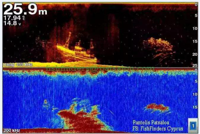
Underwater mapping, imaging system, water quality monitoring
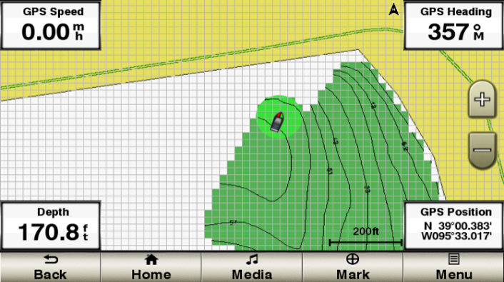
The professional transducer, the supporting software will automatically draw the map data during the navigation process, and the drawing result will be displayed in real time. You can draw it yourself as needed, and the data can be retained or shared with your friends.
Previous:
GS25 GPS Antenna
Next:
Tidal system
HOME | NEWS | Product Center | Solution | Case Presentation | Service Centre | About us
Tianjin Ocean Telecom Technology Co., Ltd. Tel: 022-25859385 E-mail:tjhysm@126.com Address:5th Floor, No. 50A, Bohai Road, Economic and Technological Development Zone, Binhai New Area, Tianjin | 
天津大海电信科技有限公司 津ICP备13000197号 版权所有 技术支持:大海电信 |